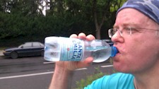
Tue, Feb 4, 2020 - 9K - 01:10:00
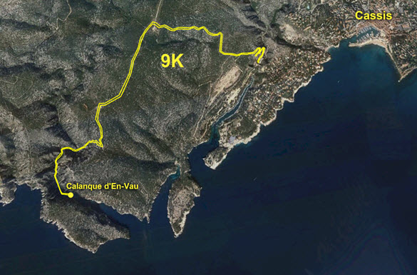
9K Les Calanques Run from Cassis to d'En-Vau
For our last full day in France, we had a 12K urban hike planned at 13:30 for the 7th arrondissement in Marseille around the Notre Dame de la Guard area, and so wanted to see the rest of the city in the morning. But when I was reading about Les Calanques (sea inlets) on the coast south-east of Marseille, I saw a picture of Calanque d'En-Vau which seemed to be a kind of paradise beach that was a bit difficult to get to since it is down in a very steep valley.
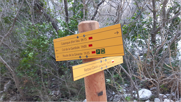
I found out that the little coastal town of Cassis was only 4.5 kilometers away and so did a little research of the trails around the Calanques enough to realize that it would be theoretically possible to run from Cassis to d'En-Vau. I showed Hannah some pictures of d'En-Vau and asked if she would like to take a run there in the morning instead of visiting Marseille before our tour, to which she responded, "Geil!".
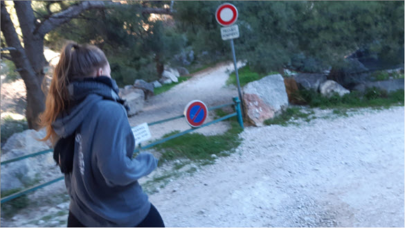
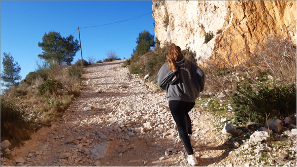
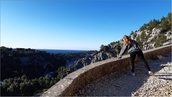
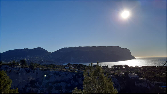
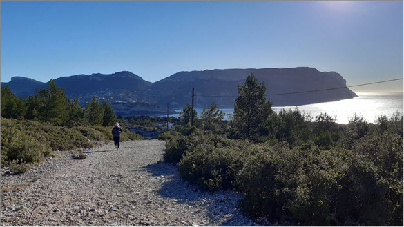
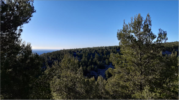
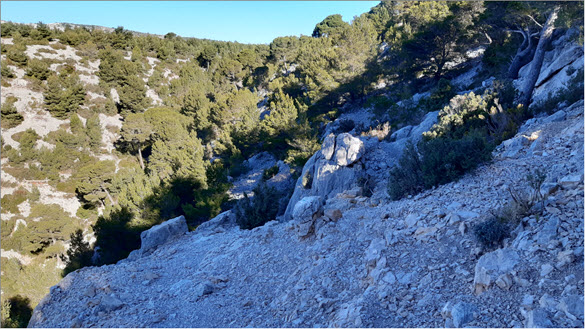
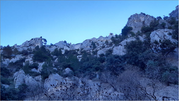
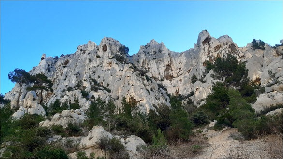
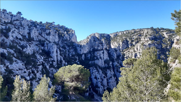
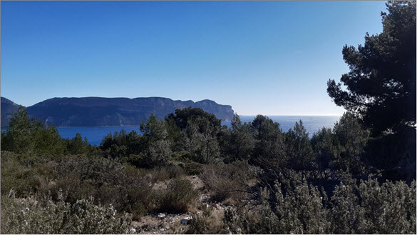
We arrived in Cassis about 10:00 at a parking lot which was right where the apparent trail to d'En-Vau started which we had found on various maps. It wound up the hill in switch-back formation which afforded us an increasingly astounding view of the Mediterranean Sea, the larger-than-life sky and sun, and the expansive Calanques landscape all around. The combination of the cold, hard-blowing Mistral wind from the north and the warmth of the sun's rays from the south was unique and energizing.
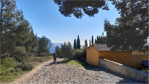
Two hikers were coming our way, so I stopped them and asked, "Connaissez-vous le chemin pour arriver au En-Vau?" They pointed in two different directions, but the one who sounded most confident said, "Continuer dans la même direction et tourner à gauche à la maison." When Hannah caught up with me, I told her this and we both could not imagine that there would be a house out here in the middle of this barren landscape. But about ten minutes later in two or three more turns of the trail, we lo and behold found ourselves approaching a house. The house was strategically pointed toward the rising sun, in front of the house was a kind of wide, open veranda and inside the veranda an older man at a table reading a newspaper and enjoying his petit déjeuner.
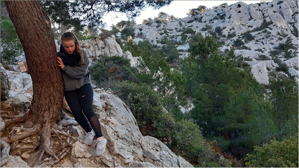
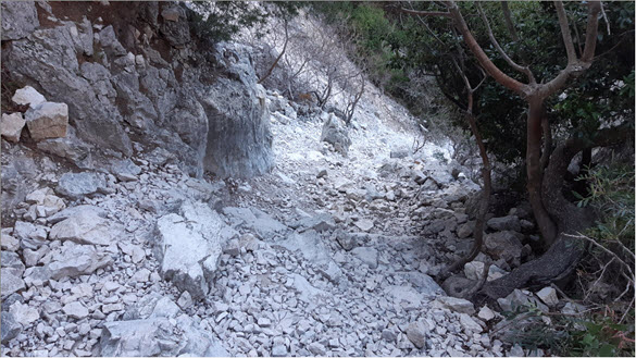
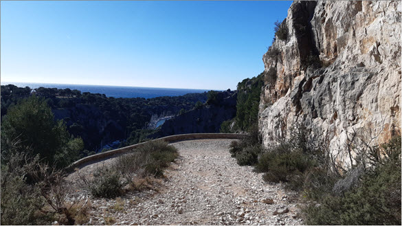
We rounded the house à gauche as instructed and were now running toward d'En-Vau. Soon it was obvious that we were at the top of a steep ravine and that we had to get down it somehow. Hannah said, "Just set a position on Google maps and click route." I shook my head at what I considered her youthful naivete and started analyzing the screenshots of maps I had made. Hannah then took her own phone, set a position on her Google maps and clicked route, and then showed me that Google maps had indeed displayed for her a dotted trail from where we were down the steep-sloped hill toward d'En-Vau.
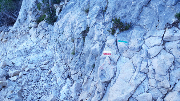
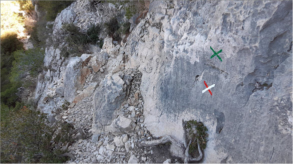
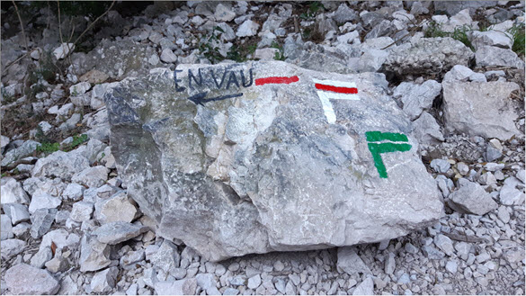
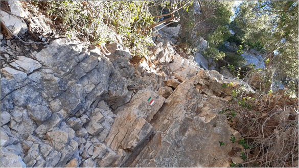
We followed the dotted trail on her Google maps but couldn't discern any kind of real trail between the trees and rocks. Then, all of a sudden, Hannah saw a painted symbol on a rock: three stripes, one white, one red, and one green. Then up ahead we saw another one. We continued looking for and finding these symbols which took us on a diagonal route down the hill and soon we could see that where we had to hold onto the rocks and trees for balance, the surface of the rocks and the bark on the trees were very smooth, as if tens of thousands of hands had already passed over them from people who had come this way before. The trail became very steep, but if you followed the symbols, there was always an obvious next step to take, and soon we were at the bottom of the ravine on a dirt road looking at a large rock with the words "D'en-Vau" and an arrow pointing south.
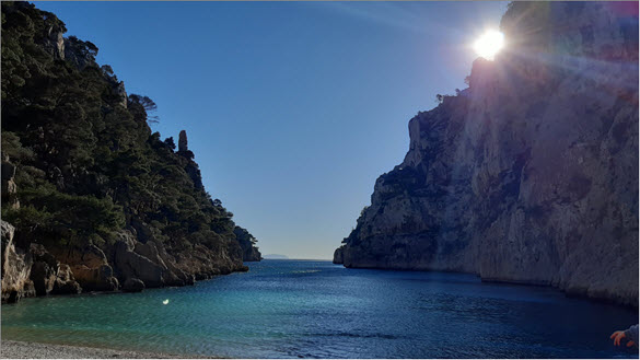
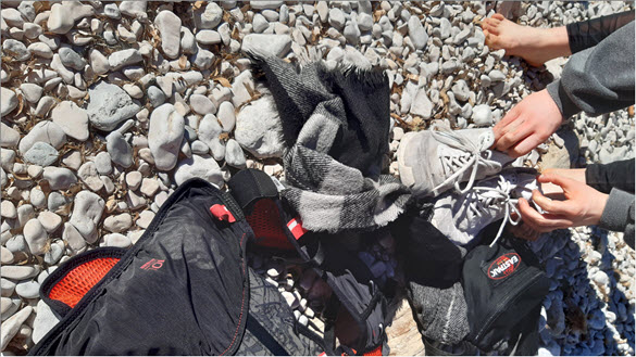
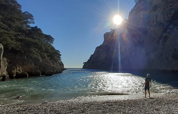
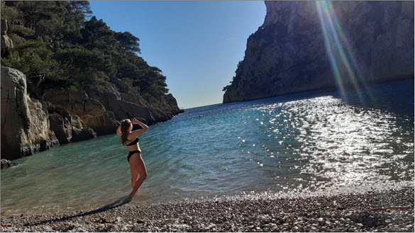
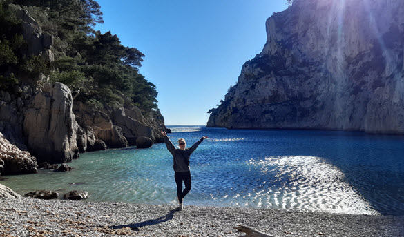
We barely even had to run, the strong Mistral wind literally blew us down the road. After a few curves, we came around the last turn. The scene presented to us at that point can only be described as paradise: a pristine empty beach with turquoise-blue water, super-high cliffs on both sides, and the sun shining its rays down into the sea inlet onto the water as small waves came crashing up onto the pebbled sand. We immediately derobed down to our swimming clothes underneath, being careful to put our running clothes under rocks and branches otherwise the wind would blow them away never to be seen again. At one point even our shoes started to tumble down the beach toward the water.
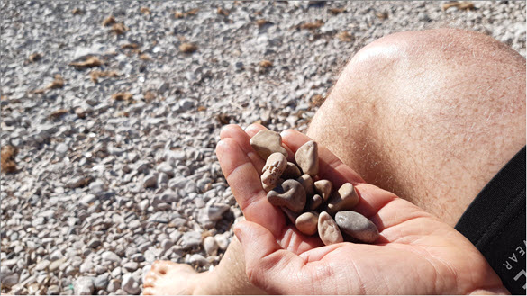
It being mid-February, the water, of course, was super icy-cold, and not a refreshing icy-cold, but a painful icy-cold. After stepping out of it, I had to walk around on the pebbled rocks and count to ten for the cold-pain to drain out of my feet. The combination of the absolutely astounding scenery and the constant blasting of the Mistral wind so hard that Hannah and I had to yell out at each other to communicate, made the few minutes we spent there one of the most unique experiences of my life.
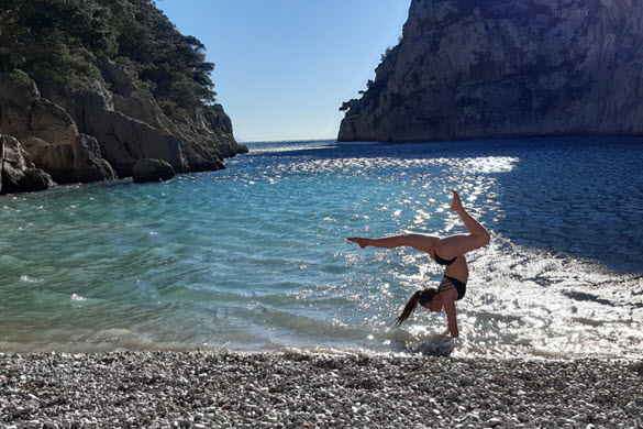
Hannah did a few hand-stand positions in the water and some poses on the beach that I got some pictures of, and then we had to take off since it was going to be a tight schedule to get back to the car, and then drive all the way to Marseille to find our tour guide for our 13:30 tour.
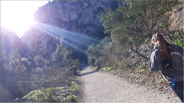
We took off down the road, and then back up the steep and rocky trail up the ravine to the top of the ridge, which didn't take but 10 minutes to climb. After that it was a relatively warmer run back down the Calanques, past the house and on the same trail all the way back to the parking lot where we parked, with absolutely beautiful scenes of the Mediterranean coast line.
From Cassis we drove at top speed to Marseille, under the Old Port, found a parking garage, hopped out, ran into a grocery store, grabbed various food as we ran down the aisles, paid for it, ate it as we ran down Rue de la République to the Old Port where we met Olivier right at 13:30 for our 12K urban hike around Marseille.


Other Runs: First Wannsee Loop, Run On August 28th, Last Run Before Berlin Marathon, Berlin Marathon 2011, 30k Birthday Run, 29k Family/ Britzer Garten Run, 10k Berlin Light Run, First Winter Run, First December Run: Rain and Christmas Lights, Bavarian Castle and Austria Run, Tegel Airport Loop -Personal Berlin Marathon, 5 Christmas Tiergarten 5 Ks Plus 10k, New Year's Run with 1000 Runners, Quick 17k Sunday Run, Half Marathon To Mendelssohn's Grave, Templehof/ Grunewald 30k, 28k Cool Winter Run To the Grimm Brothers' Cemetery, 30k Icy Sunday Winter Run Across Großziethen Crossing, Three Cold, Timed Ikea 5 Ks, 32k Berlin Wall Run with a 23:39 5k, 32k Run To Wannsee and Back Including 5k Father/ Daugther Run, 37k Stahnsdorf Loop Run Including 5k Family Run, 34k Steglitz-to-Friedrichshain Loop, 30k Steglitz/ Brandenburg Spring Run, 20k Easy Teltow Canal and Zehlendorf Suburbia Run, 13k Partner-Run Through Volkspark Wilmersdorf, 19k Run Home From Spandau, Paris Marathon 2012, Hot Weather 28k with Two Timed 5 Ks, 24k Cold Zehlendorf Run, 26k Adventure Run To Teufelsberg, 34k Sunny Run To Stralau Peninsula, 40k Run To Kleist's Grave and E Bay Headquarters, 51k Run From Strausberg To Steglitz, 28k German Soccer Fan-Mile Run, 26k Italian/ Spanish Embassy Run, 11k Kirchberg Austria Run, 35k Austrian Mountain Run, 48k Personal Berlin Marathon, 23k Run: 5k Sprint, 10k As Pacer Bunny, 24k Run with 23:31 5k and Dual 10k, Morning Training Run for Gisi's 10k Next Week, 10.5k Berlin Stadtlauf with Gisi, 6k Family Training Run, 32k Work-to-Home Run Including 13k with Hupsi Laufgruppe, 5k Tierpark Race with Whole Family, 30k Cafe-Reconnaissance Run with Family Run/ Bike Finish, 10k Timed Canal Run with Gisi, Last Run of the Marathon Season, 2012 Berlin Marathon -04:13:46 -My 2nd Fastest Marathon Ever, 28k Griebnitzsee-to-Steglitz Run, Asics Grand 10k Berlin, 7k Autumn Family Run, 21k Teltow Halfmarathon with Family, 13k Brisk Late-Fall Run, 8k with Gisi, Gritty December Winter Run, 10k Dual Snowy Winter Run, 13k New Year's Run 2013, 19k Adventure Run To Berlin's Only " Library Tree", 11k Brisk Winter Run, 6k Anti-Cough Run, 14k Cold Winter Run, 35k Trans-Berlin Run: Buch To Steglitz, 15k Cold Winter Run Together, 33k Potsdam Castle Rendez-Vous Run, 30k Run with First Timed 5k of the Year, 28k Dual Run with Timed 5k (24:43), 11k Last Run Before Half Marathon, 2013 Berlin Half Marathon, 31k First Run of Spring, Fast Pre-Marathon 10k (53:20), Madrid Marathon 04:21:12, 26k Dual Sunday Run with Gisi, 22k Rendez-Vous Run with Gisi, 12k with Hot and Slow 5k Ikea Loop (25:56), 11k Notre Dame De Paris Run, 14k Paris 15th-Arrondissement Run, 25k Run Including 10k with Family, 17k After-Work Run with 5k Sprint, 10k Sunny Weekend Run with Gisi, 6k B2run Company Run (29:18), 20k After-Work Run with Timed 5k (24:16), 10k Family Training Run In Brandenburg, 26k Run with 5k Speed Work, 23k Argentinische Allee Loop with Gisi (10 K), Timed 10k (00:50:29): Last Training Run Before Bremen Marathon, Bremen Marathon 2013, ASICS GRAND 10K, 16k Run Home From Work with 5k Sprint (00:24:36), Zehlendorf 20k, 5k with Hannah for Pete, 19k Zehlendorf Loop with Post-Swim, 7k Ullsteinhaus Run with Gisi, 10k December Dark Run, 21k Kreuzberg Run, 2014 New Year's Trash Run, 18k Dual Run with 5k (26:03), 17k Teltow Run with Gisi, 20 K/30k Zero Degree Winter Run with Gisi Including Timed 5k (24:32), 15k Freezing Teltower Canal Loop, 22k Deep Marienfelde Run with Gisi, 33k Winter-Sun/ Winter-Moon Run with Two Timed 5 Ks, 30k Schlachtensee Sunset Run, 30k One-Month-Till-Rome Training Run, 21k Brandenburg Run with Gisi, 20k Clayallee Loop: Spring Sundown Run, 15k Family Run with Pete and Gisi, 2014 Rome Marathon 04:21:17, 2014 Berlin Half Marathon, 10k Training Run with Hannah, 10k Airport Night Run with Hannah, Hannah and Gisi's 10k Frauenlauf, 10k Back In Action Summer Run, 5.5 Kilometer Berlin Firmenlauf, 5k Training Run with Hannah and Friend, Midsummer Night's 10k with Gisi, 25k World Cup Run Including Argentina Goal At Fanmeile, 3k Holland Brötchen Run with Hannah, 13k Holland Landscape Run, Schwagstorf 5k with Hannah, Morning 14k with 5k Ikea Loop (27:15), 5k Berlin City Night Run with Hannah, 15k Evening Run with Gisi, 19k Weekend Night Run with Gisi, 13k Run Home From Westend Via Lietzensee Park, 15k Morning Run, 15k Spanish Verb Conjugation Run, Berlin Mercedes Half Marathon, 15k Spanish Verb Ser/estar/haber/tener Run, 11k Run with Time 5k Run (26:10), 11k Run with Timed 5k Run (26:52), 10k Asics Grand Relay with Hannah (55:26), 32k Run Through Berlin Including Rendez-Vous with Gisi On Her 10k, 8k Run Through Prague, 12k with Timed 5k (25:32), 35k Berlin Wall Run: 7k Warm-Up, 21k Half Marathon, and 7k Warm-Down, Run Out To Ikea and Back with Timed 5k Loop (25:25), 5k Ikea Loop (24:42) with Warm-up and Warm-down, 21k Zero Degree Run, First 12k with Gisi, 25k West Berlin Run, 12k Out To Ikea Loop with 5k (25:33), 15k Hauptbahnhof To Home Run with Time Tiergarten 5k (24:50), 15k New Year's Run with Gisi, 49k Tegel Airport Loop Run, 12k Ikea Run with Gisi Including Timed 5k, 18k Tempelhof-to-Home Run with 5k Timed Tiergarten Loop, 12k To Ikea and Back with Timed 5k, 22k Casual Half Marathon Through Berlin with Gisi, 19k Late Afternoon / Night Run, Barcelona Marathon 2015 (04:27:57), 9k Sunny, Chilly, Sunday Run with Gisi, Casual Half Marathon with Gisi To Krumme Lanke and Back, 20k One-Way Urban Run with Gisi From Treptow Park Home To Steglitz, 13k Run with Gisi From Charlottenburg To Steglitz, 14k with Gisi From Gropiusstadt To Steglitz, 14k Family Run/ Bike Trek, Berlin Big 25 Race with Gisi, 12k First Road-to-Athens Training Run with 5k Timed Run (27:11), 23k West Berlin Loop, 31k Sunny Run Through West Berlin, 38k Grunewald Loop Run, 19k Brocken Summit Run, 13k Late Summer Night Run, 26k End of Summer Run, 19k Schmargendorf Loop, 16k Running Weekend with Timed 5k (27:19 Ugh), 36k Run To Bertolt Brecht's Grave, 30k Run Through Berlin, 10k with the Berlin Marathoners, 32k Kreuzberg/ Zehlendorf/ Steglitz Run, 15k with Gisi, 20k Krumme Lanke Run with Gisi, Müggelsee Half Marathon with Gisi, 12k Ikea Loop with Timed 5k (26:36), Athens Marathon -the Authentic, 18k First Winter Snow Run, 26k Run To Reichstag and Back, Including 5k with the Green Runners, 15k New Year's Run with Gisi, Including 4k with 4,500 Runners In Neujahrslauf, 25k David Bowie Memorial Run, 14k Run To the Brother Grimms' Graves, 16k Teltow Run with Gisi, 11k Valentine's Day Run, 22k Rainy Zehlendorf-Teltow Run, 10k Lankwitz Run with Gisi, 18k Volkspark Loop with Gisi, 20k Prenzlauerberg To Steglitz Run with Gisi, 13k Posh Run From Koenigsallee To Steglitz, 10k Lankwitz Reconnaissance Run, 2016 Berlin Half Marathon, 28k Hauptbahnhof To Home Run Through East Berlin, 32k Grunewald Trek To See Nico's Grave, 33k Run From Mitte To Steglitz Around Tegel Airport, 12k Ikea Loop with Timed 5k (25:39), 31k Stahnsdorf Cemetery Run, 2016 Berlin Firmenlauf (5k = 24:03), 4.5 Kilometer Family Run In Leegebruch, Potsdam Half Marathon (02:23:58), 21k with Three Timed 5 Ks (25:11, 28:21, 33:23), 15k with Timed Tiergarten 5k (25:10), After-Work 10k with Timed 5k (24:58), 49k Mega-Run To Marzahn and Back, After-Work 10k with Timed 5k (26:25), 7k Schlachtensee Lake Run with Gisi, After-Work 10k with Timed 5k (24:46), Heidelberg Castle Run, 12k Strasbourg Run, Personal Triathlon: 10k Run / 21k Bike / 1k Swim, Second Personal Triathlon: 20k Run / 21k Bike / 1k Swim, 30k Steglitz-to-Mitte Loop, 8k Last Training Run Before Warsaw, Warsaw Marathon, 19k Birthday Run Through Zehlendorf, 12k Autumn Krumme Lanke Run with Gisi, 16k Genshagen Run Through Brandenburg Farmland, 15k Run To Rathaus Schöneberg, 13k Run with Gisi From Potsdamer Platz To Steglitz, 24k Winter Solstice Run From Pankow To Steglitz, 20k Niedersächsischer Landlauf, 15k New Year's Run To Teltow with Gisi, 29k Wintry Run Through the Grunewald, 17k Sunny Cold Run Through Zehlendorf with Gisi, 11k Sunny Cold Run From Alt-Moabit To Steglitz with Gisi, 23k Run From Charlottenburg Schloss To Steglitz Via Grunewald, 28k Run From Schönefeld Airport To Steglitz, 10k Waren an Der Müritz Winterlauf with Hannah, 25k South Berlin Wall Run, 16k Run Home From Work Via Brandenburg Gate, 30k Run From Frohnau To Steglitz, 16k Cold and Wet Teltow Run with Gisi, 11k Last Winter Training Run, with Gisi, 2017 Berlin Half Marathon, 2017 Zurich Marathon, 29k Berlin Wall Run with Andreas, 9k Run with 5k Timed Ikea Loop (25:33), After-Work 10k with Timed 5k (24:45), 28k Run: Timed 5k (24:55) Following Karla On Bike, Last 15k with Gisi, After-Work 10k with Timed 5k (24:41), Tiergarten 5k (00:24:58) with 4k Warm-up and 2k Warm-down, After-Work 10k with Timed 5k (24:40), 11k To Ikea and Back with Timed 5k (24:35), 58k Bike Ride To Potsdam/ Babelsberg and Back, 30k Bike Ride To Schloss Diedersdorf and Back, Potsdam Duathlon: 46k Bike / 1k Swim, 16k Morning Run Through Rome, 5k Berlin Life Run Around Former Tempelhof Airport, 15k Teltow Canal Run with Gisi, 17k Brandenburg Run From Netzen To Kloster Lehnin and Back, 18k To Ikea and Back Then To Teltow with Gisi, 17k Lichterfelde To Ikea Loop, 5k Run for the Great 10k Berlin Relay Race with Hannah, 13k Run Home From Work, 9k Run Through Dahlem with Gisi, 11k After-Work Run with Timed 5k (25:29), 38k Reformation Day Mega-Run, 14k Grunewald Forest/ Lake Run with Gisi, 21k After-Work Half Marathon, with Timed 5k (25:01), 12k with Timed 5k Ikea Run (24:31), 11k After-Work Run with Timed Tiergarten 5k (24:01), 12k Run To Ikea with Timed 5k (24:22), 11k After-Work Run with Timed Tiergarten 5k (24:08), 5k Scb Berlin Grunewald Run with Hannah, 11k After-Work Run with Timed Tiergarten 5k (23:48), 12k Run To Ikea with Timed 5k (23:59), 11k After-Work Run with Timed Tiergarten 5k (24:01), 26k Run To Ikea with Timed 5k (23:54) and Run To Teltow with Gisi, 11k To Ikea and Back with Timed 5k (23:48), 23k Niedersachsen Run To Kalkriese and Back, 21k New Year's Run with Timed 5k (24:07) and 7k with Gisi, 11k After-Work Run with Timed Tiergarten 5k (23:59), 11k To Ikea and Back with Timed 5k (23:17), 11k After-Work Run with Timed Tiergarten 5k (23:38), 20k Including Timed 5k Ikea Loop (23:19) and 6k with Gisi, 13k After-Work Run with Timed Tiergarten 5k (23:48), 12k After-Work Run, 21k Personal Half Marathon with Two Timed 5 Ks, 29k Run To Europarc Dreilinden and Back, 11k To Ikea and Back with Timed 5k (24:26), 5.6 Kilometer Scb Teufelsberg Run with Hannah, 13k Run with Gisi Including Timed 5k Ikea Run (24:54), 11k To Ikea and Back with Timed 5k (24:18), 24k Through Berlin with Timed Tiergarten 5k (24:30), 11k To Ikea and Back with Timed 5k (24:11), 11k To Ikea and Back with Timed 5k (24:19), 11k To Ikea and Back with Timed 5k (23:54), 11k To Ikea and Back with Timed 5k (23:55), 11k To Ikea and Back with Timed 5k (23:58), 35k One-Month-Before-Marathon Run with Two Timed 5 Ks (23:41 and 27:27), Störitzsee 10k Lauf with Hannah and Gisi, 11k To Ikea and Back with Timed 5k (23:38), 17k Through Brandenburg with Gisi and Thorsten, 11k To Ikea and Back with Timed 5k (23:27), 30k To Zehlendorf Run with Gisi (18 K), Including Timed 5k (23:44), 11k To Ikea and Back with Timed 5k (23:42), 20k Run Home From New Work In East Berlin with 5k Timed Tiergarten Run (23:47), 10k Airport Night Run with Hannah, Nantes Marathon 2018, Hamburg Half Marathon with Gisi, 16k Run Home From Hauptbahnhof with Ikea 5k Timed Run (25:22), 24k Run Home From Work with Tiergarten 5k Timed Run (25:19), 8k Run with Double 5k Timed Run: Eddie (24:54), Gisi (34:21), 20k Run Home From Work, 10k Frauenlauf Gisi/ Hannah, 5k Karla, 11k To Ikea and Back with Timed 5k (24:45), 15k After-Work Run with Timed 5k (25:10), 10k Potsdamer Schlösserlauf with Hannah, 22k Run Home From Work with Timed Ikea 5k (27:02), 11k To Ikea and Back with Timed 5k (25:02), 9k To Ikea and Back with Timed 5k (25:19), 14k After-Work Run with Timed Tiergarten 5 K (24:52), 10k Freie Universität Campus Run with Hannah and Gisi, 14k After-Work Run with Timed Tiergarten 5 K (25:33), 15k Run Through Stralsund and Countryside, Dual 5k Timed Ikea Loop: Eddie (25:33), Hannah (35:00), 14k After-Work 34°c Run with Timed Tiergarten 5k (25:58), 9k To Ikea and Back with Timed 5k (25:23), 15k After-Work Run From Sonnenallee with Timed 5k Ikea Loop (25:42), 9k To Ikea and Back with Timed 5k (24:58), 19k After-Work Run with Timed Tiergarten 5k (26:47), 9k To Ikea and Back with Timed 5k (24:55), 16k Run Home From Work with Timed Tiergarten 5k (25:27), 10k Steglitz Sports Scheck Run with Gisi and Hannah, 20k Run Home From Ostkreuz with Timed-5k Ikea Loop (26:24), 13k Run Home From Work with Timed-5k Tiergarten Loop (24:32), Prague 10k Night Run with Hannah, 9k Home From Work Run with Timed Ikea 5k (24:24), 35k Mega-Run To the Bye-Bye-Plastic Demo and Back, 11k Rainy Run From Hauptbahnhof To Innsbrucker Platz with Timed Tiergarten 5k (23:56), 9k Home From Work Run with Timed Ikea 5k (23:45), 17k To Ikea and Back and Second Round with Gisi Including Timed 5k (23:53), 9k From Südkreuz Home with Timed Ikea 5k (24:17), 9k Home From Work Run with Timed Ikea 5k (23:34), Shoreditch 10k In London with Hannah (01:07:47), 6k Morning Run Through Warsaw, 13k Home-from-Halensee Grunewald-Run with Gisi, 15k Run To Teltow and Back with Gisi, 14k After-Work Run with Timed Tiergarten 5k (24:29), 10k Tegeler Forst Crosslauf with Hannah and Gisi, 11k To Ikea and Back with Timed 5k (24:20), 20k Run Home From Work with Timed Tiergarten 5k (23:56), 12k Run From Wilmersdorf To Tiergarten, with Timed 5k (23:43), 13k Run Home From Work with Timed-5k Tiergarten Loop (23:33), 15k Sunday Run with Gisi Including Timed-5k Ikea Loop (23:58), 13k Run Home From Work with Timed-5k Tiergarten Loop (23:50), Plänterwald Run with Hannah and Gisi, 42k Land-And-Water Mega Run Via Wannsee, Alt-Kladow, and Spandau, 11k Christmas Day Run To Ikea and Back with Timed 5k (23:37), 11k New Year's Day Run To Ikea and Back with Timed 5k (23:47), 16k Tempelhof-Mariendorf-Lankwitz Run with Timed 5k (23:29), 13k After-Work Run with Timed Tiergarten 5k (23:57), 10k Caputher Seelauf with Hannah and Gisi, 37k Land-and-Water Run From Spandau To Steglitz with Timed 5k Spandauer Winterwaldlauf (23:19), 13k After-Work Run with Timed Tiergarten 5k (23:44), 11k Steglitz-to-Zehlendorf Run with Gisi, Plänterwaldlauf with Karla, Hannah and Gisi, Sevilla Marathon, 18k Including 5 K-Timed (23:53) and 7k with Gisi, 20k Steglitz-Dahlem-Zehlendorf Run with Gisi, 18k Including 8k Warm-Up and 10k with Hannah ( Karla 5 K) In the Lauf Der Sympathie From Falkensee To Spandau, 20k Steglitz-Marienfelde-Lichtenrade Mauerweg Run with Gisi, 11k First Spring Run: To Ikea and Back with Timed 5k (24:33), 21k Poznan Half-Marathon with Gisi (02:18:51), 14k Potsdam Rbb-Drittelmarathon, 11k Ikea and Back with Timed 5k (24:30), 11k Ikea and Back with Timed 5k (24:05), 25k Ikea To Königsbergerstr. and Back with Two Timed 5k Runs (23:56, 26:29), 13k After-Work Run with Timed Tiergarten 5k (23:51), Sunday Quadrathlon: 11k Run, 15k Bike, 1k Swim, 2 König Pilseners, After-Work Duathlon: 9k with 5 K-Timed-ike A-Run (23:57) and 1k Swim, Potsdam Schlösserlauf Half Marathon (02:12:53), Altenburg 13.3 Kilometer Run with Hannah, 7k Run with Steglitzer Lauftreff Group, 24k Morning Run Through Vienna, 15k Schwerin Run, 14k Zehlendorf To Steglitz Run, 17k Run Home From Work, 15k Teltow Canal Weekend Run with Gisi, 9k Dahlem To Steglitz Via Ikea with 5k Timed-Run (25:53), 17k Run Home After Work with Timed 5k (25:24) Plus 7k with the Steglitz Laufgruppe, 10k Kreuzberger Viertelmarathon, 9k with 5 K-Timed-ike A-Run (25:44), 9k After-Work Run with Ikea 5k Timed-Run (24:58), 10k Tierparklauf with Gisi, Karla and Simon, Schloss Hakeburg Half-Marathon Training Run with Gisi, Oslo Half Marathon with Hannah, Last Summer Run and Last Swim In Insulaner Freibad, with Times 5k Run (24:57), Sixth Morning Run with Hannah, 15k German Unification Day Run To the Brandenburg Gate, with 5 K-Timed-ike A-Run (24:37), 9k with 5 K-Timed-ike A-Run (24:27), 21k Leipzig Half Marathon with Gisi, 13k Run Home From Work with Tiergarten 5k (24:56), 15k Hermsdorfer Sägeserie Hill Run with Hannah, 13k Run Home From Work with Tiergarten 5k (24:41), 9k with 5 K-Timed-ike A-Run (24:28), 9k Dark Halloween Run with 5 K-Timed-ike A-Run (24:14), Sunday Afternoon Run with 5 K-Timed-ike A-Run (24:23), First Early Morning Dark and Rainy Run with Hannah, 15k Run with Timed Ikea 5k (24:32) Then Caught Up To Gisi On Her 15k Run, Second Early Morning Dark Run with Hannah, 13k After-Work Run with Timed Tiergarten 5k (24:05), 15k Tropical Islands Run with Hannah, Third Morning Run with Hannah, 13k After-Work Run with Timed Tiergarten 5k (24:07), Sunday Afternoon Run with 5 K-Timed-ike A-Run (23:56), Fourth Morning Run with Hannah, 13k After-Work Run with Timed Tiergarten 5k (23:46), After-Work Timed Tiergarten 5k (23:59), Sunday Afternoon Run with 5 K-Timed-ike A-Run (23:40), Fifth Morning Run with Hannah, 13k Run Home From Work with Tiergarten 5k (23:51), 10k Britzer Garten Lauf, 13k Run Home From Work with Tiergarten 5k (23:51), Sunday Afternoon Run with 5 K-Timed-ike A-Run (23:39), 15k Pulled-Hamstring Recovery Run, Seventh Morning Run with Hannah -38:46 ( First Day-Light Run), Eighth 6k Morning Run with Hannah -37:00, 4k First Track Training Run with Hannah, Ninth 6k Morning Run with Hannah -38:35, 17k After-Work Night Run Home, Tenth 6k Morning Run with Hannah -37:21, 22k After-Work Night Run Home, 5k Winterlauf Spandau with Hannah (27:36), 11th Morning Run with Hannah, First 7k (45:19), 22k Light-to-Dark Run Zehlendorf Run with 4k Running Path Discovery, 23k Trail Givré, Montanay, France, 9k Les Calanques Run From Cassis To D' En-Vau, 37k Teltow-Zehlendorf-Schlachtensee-Schöneberg Run, 25k After-Work Run Home, 15k After-Work Run Home From Work Via Kreuzberg, 33k After-Work Run Home Via Pankow, 35k Berlin Wall Run Including 10k with Gisi On Her 15k Run, 22k After-Work Run Home From Work Via Plänterwald, 16k After-Work Run Home From Work Via Kreuzberg, 20k Griebnitzsee To Steglitz Run with Gisi, 12th Morning Run with Hannah, Second 7k (49:24), 27k After-Work Run Home Via Grunewald Und Zehlendorf, 10k Grunewald Exclusive Run with Gisi (01:15:09), 10k Grunewald Exclusive Run with Hannah (01:11:46), 6k Second Early-Morning Sprint Training Run with Hannah, 12k Lankwitz-Lichterfeld Run with Gisi, 13th Morning Run with Hannah, Third 7k (47:34), 42k Jüterbog Solo-Marathon, 14th Training Run with Hannah, Fourth 7k (48:14), First Ikea 5k Training Run with Hannah (24:37 / 31:42), Oehna-to-Jüterbog 16k with Hannah Including a 3k To Lichterfelde-Ost and Back, 2x Ikea 5k Speed Runs (24:52, 27:43), 1x with Hannah (32:03), 15th Morning Training Run with Hannah, Fifth 7k (47:23), 3x Ikea 5k Speed Runs (25:11, 29:49, 32:03), 1x with Hannah (32:44), 3x Ikea 5k Speed Runs (24:56, 26:36, 28:56), 1x with Hannah (29:31), Hannah's and My Third Official Corona-Era Do-It-Yourself Proactive Solo-Race: 10k Tempelhofer Feld (01:01:37), 3x Ikea 5k Speed Runs (25:11, 27:25, 28:35), 1x with Hannah (28:43), 19k Spandau-to-Steglitz-via-Grunewald After-Work Trek Including Scouting Run for Next Month's Pichelsberg-to-Clayallee 10k, 3x Ikea 5k Speed Runs (24:47, 25:53, 28:28), 1x with Hannah (28:38), 15k Pichelsberg To Friedenau Run with Gisi, 2x Ikea 5k Speed Runs (24:48, 28:21), 1x with Hannah (29:05), After-Work 3x Ikea 5k Speed Runs (25:09, 27:57, 28:25:59), 1x with Hannah (28:25:53), 28th Monthly 10 K+ Race with Hannah: Pichelsberg To Schmargendorf Via Grunewald, After-Work 3x Ikea 5k Speed Runs (24:46, 28:04, 30:40), 3rd Round with Hannah (29:49), After-Work 3x Ikea 5k Speed Runs (25:41, 28:38, 29:34), 3rd Round with Hannah (30:30), 16k After-Work Run Home Via Kreuzberg, 16k Havel/ Grunewald Run with Gisi, 15k Erfurt Morning Run with Hannah, 9k After-Work Run with Ikea 5k Timed-Run (25:02), 9k After-Work Run with Ikea 5k Timed-Run (24:48), 9k After-Work Sunny Run with Ikea 5k Timed-Run (25:06), 19k After-Work Run with Three Ikea 5 Ks (25:10, 30:12, 30:42) Third 5k with Hannah (29:21), 10k Tempelhofer Feld, Hannah's and My 30th 10 K+ Monthly Run and Sixth Official Corona-Era Race (01:10:52), Plus After-Race Freibad Swim with Gisi, 14k Including Double Ikea 5 Ks (24:27, 27:14) Plus 12-Minute 2.23 Kilometer Spring with Hannah, Two 12-Minute Sprints with Hannah (05:16/km Pace), 10k Müggelturm Lauf with Hannah (01:04:20), Two Fast Evening Ikea 5 Ks with Hannah (24:36 / 28:31), 10k Cottbus Race with Hannah (00:57:37), 9k Run To Osdorferstr. S-Bahnhof with Gisi, Fast Evening Ikea 5k with Hannah (24:01 / 28:13), Autumn Run To Teltow with Gisi, Late Autumn Run with Gisi To Osdorfer Straße, 10k Urban-Race Preparation-Scout-Run From Teltow Back Home, 10k Urban-Race Trial-Run with Hannah, 16th Restarted Early-Morning Winter 7k Run with Hannah, 25k Neukölln Run with 11.8k Trial Run for This Month's Urban Race with Hannah, 12k Winter Solstice Urban Race Against Hannah (10 K), 12k Priesterweg-Schöneberg Snowy Run with Gisi, Frosty 5k Ikea Morning Sprint with Hannah (26:04 / 33:54), 18k From Wuhlheide To Steglitz, 12k Schöneberg Run with Gisi Including Ikea 5k Sprint (25:42), 20k Wuhlheide-to-Steglitz Run with Hannah, 26k Dreilinden-to-Steglitz Run with Hannah, 12k Schöneberg Run with Gisi Including Ikea 5k Sprint (25:45), 14th Morning Run with Hannah, 7k (42:58), 30k Scouting Run Along Berlin Wall, 30k Adlershof-to-Steglitz Morning Run Along Former Berlin Wall, 30k Run Along Berlin Wall Meeting Hannah At 20k, From Griebnitzsee To Dreilinden 6k with Hannah and Then a 10k with Gisi Through Dahlem, 5k Ikea Timed Run (29:42) with Hannah, 5k Ikea Timed Run (29:32), 5k Ikea Timed Run (27:48), 5k Ikea Timed Run (27:35), 30k Frauenlauf, 5k Ikea Timed Run (27:32), 5k Ikea Timed Run (26:40), 5k Ikea Timed Run (26:28), 5k Ikea Timed Run (26:48), 5k Ikea Timed Run (26:17), 5k Ikea Timed Run (26:02), 5k Ikea Timed Run (26:02), 31k Berlin-Wall Run To Outdoor Pool Plus 12-Lap Swim, 5k Ikea Timed Run (26:02), 33k Steglitz-Zehlendorf-Schlachtensee To Schöneberg Run + 12 Lap Swim, 5k Ikea Timed Run (29:49), 35k Run From Ahrensfelde To Steglitz, 5k Lübben Race with Hannah, 37k Run From Frohnau To Steglitz, 5k Ikea Timed Run (27:19), 39k Run Through Berlin From Hennigsdorf To Steglitz Via Spandau, 41k Run Through Berlin From Hennigsdorf To Steglitz Via Siemensstadt and Tegel, 46k Berliner Vollmond-Ultramarathon, 6k Semlin Lake Run with Gisi and Hannah, 5k Ikea Timed Run (29:00), 6k Dresden Night Run with Hannah, 5k Ikea Timed Run (27:46), 5k Ikea Timed Run (27:42), 5k Ikea Timed Run (28:09), 5k Ikea Timed Run (27:12), 5k Ikea Timed Run (27:12), 5k Ikea Timed Run (28:03), 5.5k Berliner Firmenlauf, 18k Trail Run Berlin, 25k Adlershof To Steglitz, Last 10k with Hannah, 34k Golm To Steglitz, 25k S25 Berlin Race with Hannah, 5k Ikea Timed Run (26:07), 36k Last-Before-Marathon Run, 42k Rotterdam Marathon, 5k Gh O-to-Home Through Lankwitz, 5k Ikea Timed Run (29:38), 5k Griebnitzsee To Dreilinden -10°c Run, 2x 5k Ikea Timed Run (28:42 / 30:19), 5k Ikea Timed Run (27:30), 5k Ikea Timed Run (27:21), 5k Ikea Timed Run (26:44), 10k with Gisi From Gho Home Via Berlin Wall Trail, 5k Spandau Winterlauf (26:07) and 24k Warm-down, 5k Ikea Timed Run (26:55), 15k Run Home From Hauptbahnhof with Tiergarten 5k (26:47), 5k Ikea Timed Run (27:06), 5k Ikea Timed Run (26:57), 5k Ikea Timed Run (26:34), 5k Ikea Timed Run (26:30), 26k Dreilinden To Steglitz, 5k Ikea Timed Run (26:57), 29k Steglitz-Kreuzberg-Marienfelde, 10k Run with Gisi Through Marienfelde, 5k Ikea Timed Run (27:41), 5k Ikea Timed Run (27:18), 5k Ikea Timed Run (27:35), 10k Run with Gisi Through Marienfelde, 21k Teltow-Lichterfelde Half Marathon (counter-clockwise), 5k Ikea Timed Run (27:25), 15k Lichterfelde-Kanal Run with Gisi, 5k Ikea Timed Run (27:55), 5k Ikea Timed Run (28:10), 21k Teltow-Lichterfelde Half Marathon, Clockwise (02:10:39), 5k Ikea Timed Run (27:49), 21k Teltow-Lichterfelde Half Marathon, Counter-clockwise (02:07:54), 11k with 5k Ikea Timed Run (27:38), 22k Kreuzberg To Steglitz Run, 11k with 5k Ikea Timed Run (26:52), 21k After-Work Teltow-Lichterfelde Half Marathon Clockwise (02:24:08), 5k Run To Power Gymnastics and Back, 30k Potsdam To Steglitz Run, Last 5k with Hannah, 12k with 5k Ikea Timed Run (26:58), 11k with 5k Ikea Timed Run (26:49), 11k with 5k Ikea Timed Run (26:56), 5k Tegel Jedermannlauf with Hannah, 21k Teltow-Lichterfelde After-Work Half Marathon, Counter-clockwise (02:23:15), 21k Wittstock Half Marathon (01:58:26), 7k Lichterfelde-Lankwitz Loop with Hannah, 11k with 5k Ikea Timed Run (26:50), 21k After-Work Teltow-Lichterfelde Half Marathon Clockwise (02:23:35), 11k with 5k Ikea Timed Run (27:27), Potsdam Schlösserlauf Half Marathon (02:19:19), 11k with 5k Ikea Timed Run (27:34), 11k with 5k Ikea Timed Run (27:45), 2022 Berliner Firmenlauf, 11k with 5k Ikea Timed Run (27:58), 11k with 5k Ikea Timed Run (27:18), 16k Run To Tiergarten with Timed 5k (28:19) and 2k Warm-down with Dci Run Club, 5k Ikea Run with Hannah, 11k with 5k Ikea Timed Run (27:30) + 10 Laps Swimming, 7k Schwagstorf Loop Around Kronensee with Hannah, 22k Farewell-to-Schwagstorf Run, 15k with Hannah Including 5k Ikea Timed Run (28:51), 12k Including 5k Ikea Timed Run (27:55), 24k Hohenzollerdamm To Steglitz Run, 5k Timed Run (28:41) -Road Karla's Bike To Start and Back, 26k Gesundbrunnen To Steglitz with 10-lap Swim, 28k Run Including 10k with Hannah In Henningsdorf Race, 30k Adlershof-to-Steglitz Marathon-Training Run Along Former Berlin Wall, 32k Blankenfelde To Steglitz, 34k Spandau To Steglitz Including Last 10k with Hannah, 36k Buch To Steglitz Including 7k Berlin Marathon Infiltration, 38k Mahlsdorf To Steglitz Run, 35k Golm To Spandau Run, 10k Great 10k Berlin, Bilbao Night Marathon, 10k Tempelhofer Feld Night Run with Gisi, 22k Run From Dahlem To Steglitz Via Zehlendorf, 21k Nikolaus Half Marathon Around Schlachtensee, 11k with 5k Ikea Timed Run (30:36), 15k with Gisi On Extended Marienfelde/ Lichterfelde Loop, 26k Run From Weissen See To Steglitz with Hannah, SHOW ALL 607